
Problem and case
Why site-specific interpretation matters.
TL;DR
OESIS combines local readings, site context, and public hazard feeds into one parcel view so people responsible for a site can make better decisions with reasons and uncertainty shown.
This page explains the product gap in plain language: one site view that is easier to act on than map-only feeds or isolated sensors.
What problem this solves
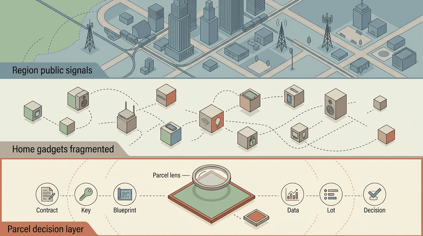
Regional maps and single-purpose sensors both help, but people still have to do hard interpretation on their own: what is most plausible at this site right now?
In practice, that means making high-stakes calls with incomplete context:
- Is indoor air likely safe enough to shelter?
- Should windows stay open or closed?
- Is this site safer to reenter now, or later?
OESIS focuses on that gap. It combines local readings, site context, and public hazard feeds into one parcel view so occupants and operators can see what is observed, what is inferred, and how strong the evidence is.
Parcel-state outputs are advisory, not emergency commands. The product is designed to complement official alerts and on-scene judgment, not replace them.
Why this approach is different
- One site story, not scattered tools. You get one property-facing view instead of switching between unrelated charts and apps.
- Evidence stays legible. The product distinguishes observed signals from estimated conditions and shows reasons, not only a color or score.
- Uncertainty is explicit. Confidence and freshness are visible so a user can judge how much to trust a recommendation.
- Ownership stays local. Parcel-linked data is private by default; broader sharing is opt-in and policy-gated.
OESIS compared to common approaches
| Approach | What it does well | What it misses | What OESIS adds |
|---|---|---|---|
| Regional maps and alerts | Broad situational awareness across large areas | Site-level interpretation and indoor relevance for one location | Parcel-level interpretation with local divergence and confidence shown |
| Standalone consumer sensors | Direct local measurements | Cross-signal synthesis and clear reasoning across sources | Fused parcel view with observed vs inferred framing and evidence modes |
| Smart-home automation tools | Device control and convenience | Hazard interpretation and uncertainty-aware environmental reasoning | Hazard-aware, advisory-first parcel-state outputs before bounded controls |
| Institutional dashboards | Program-level monitoring and reporting | Site-scale ownership, opt-in sharing, and parcel stewardship | Private-by-default parcel model with policy-gated sharing and clear claim boundaries |
What is implemented today
Today, the program is focused on proving a credible single-site system:
- End-to-end pipeline from sensor ingest to parcel interpretation.
- Evidence modes that separate measured data from inferred conditions.
- Three hazard tracks in scope: smoke, heat, and flood.
- Derived site statuses for shelter, reentry, egress, and asset risk.
- Trust and governance enforcement across freshness, confidence, consent, and revocation.
Some capabilities are fully in, while others are still in progress.
Near-term work sets the contracts, governance boundaries, and field practices that later phases depend on.
What expands later
The parcel remains the anchor. Later phases expand in three directions:
- Interior response verification. Confirm whether building actions improved real indoor conditions.
- Neighbor-aware signals. Allow coarse, privacy-preserving sharing between nearby sites.
- Neighborhood coordination. Improve shared awareness while preserving local control.
These are roadmap directions, not claims that multi-parcel capabilities are already fully operational.
Trust boundary
OESIS does not claim to replace official alerts, emergency services, or on-scene judgment. Parcel-state outputs are advisory estimates with explicit uncertainty. See Governance and privacy for ownership, sharing, and claim boundaries.